
New Delhi:
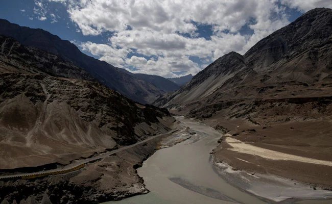
Ladakh is an “integral and inalienable part of India”, New Delhi underlined on Tuesday after China raised objections as the Central government identified and standardised the names of 28 strategic places and geographical features in the Union Territory of Ladakh for official mapping.
On October 2, India formally identified 28 strategic locations and geographical features in Ladakh, including key border friction points along the Line of Actual Control (LAC) such as Gogra and Hot Spring, on the official Indian map.
The step, taken by the government in consultation with the Ladakh administration, aims at streamlining official cartography, facilitating precise identification, and fostering better public awareness of the sensitive border region.
“Identifying these places formally on the Survey of India map of UT of Ladakh is aimed at facilitating their accurate recognition and better awareness among the public at large,” the Ministry of External Affairs said in a statement today.
Gogra and Hot Spring are among the major strategic locations and were friction points during the 2020 standoff between Indian and Chinese forces. The locations are crucial for Indian patrolling along the LAC.
“It is reiterated that the UT of Ladakh is an integral and inalienable part of India. No amount of denial by the Chinese side can change this established fact,” the Minstry underscored.
Reacting to New Delhi’s step to cement its geographical records, Chinese Foreign Ministry spokesperson Mao Ning, as reported by The Global Times on Tuesday, made claims over the Indian territory, alleging that India’s move was illegal.
“China has never recognised the so-called “Union Territory of Ladakh” unilaterally and illegally established by India and firmly opposes India’s announcement of so-called standard names. The move is illegal and invalid and cannot change the fact that the relevant areas in the western sector of the China-India boundary have always belonged to China,” Mao said as quoted by The Global Times.
By establishing standardised names and incorporating these 28 key locations onto the Survey of India’s official map, India has reinforced administrative clarity and territorial transparency, blunting China’s claims.
The 2020 Clash
The eastern Ladakh border standoff erupted on May 5, 2020, following a violent clash between Indian and Chinese troops in the Pangong Lake area. Both sides began the disengagement process in 2022.
The other locations identified by India include Alisha Giri, a high-altitude peak; Brangsa; Chapchingal Pass; Kanishka Peak; Karun Pir mountain; Kuksel; Martand Giri; Parpik glacier; Skamri Glacier; Shachmirik Pass; Shkorga Valley; Zorawar Peak; Dehra Compass; and Drak Karpo.
The list also includes Jolmori, Kumarayana Point, Panglung, Rinchen Zangpo, Sakyasri Giri, Guru Rinpoche, Shamal Lungpa (a patrol and staging route in the 1950s), Yangpa River, Marpa Lotsava Ri, Milarepa Kangri, Shiva Ri and Maheshwara Ri.